Showing posts with label reiseblog. Show all posts

Wednesday, September 25, 2019

Silvertone Chicago Vol.1


The corn cob towers.

This is the first time I've posted to the Chicago Neighborhoods Project in years. I stopped because I found trying to keep up with several types of social media was too time consuming. I am most active on Twitter at @ChiNeighbor. I have been tweeting videos of the city. I also feature snippets of Chicago Tribune newspaper articles from 1893 about the city and the World's Fair.

My longer term project is tentatively called "Tarot in the White City: Instructions, History and Advice from Chicago." I envision this as a book as centered around the amazing research about tarot that emerged in the early 1890s. Part of this knowledge has gone back into obscurity. For fun, I've designed a way to read tarot with a set of dominoes, a partial deck of playing cards, and a partial deck of modern tarot cards.

Visual Journal of the Fantastical City

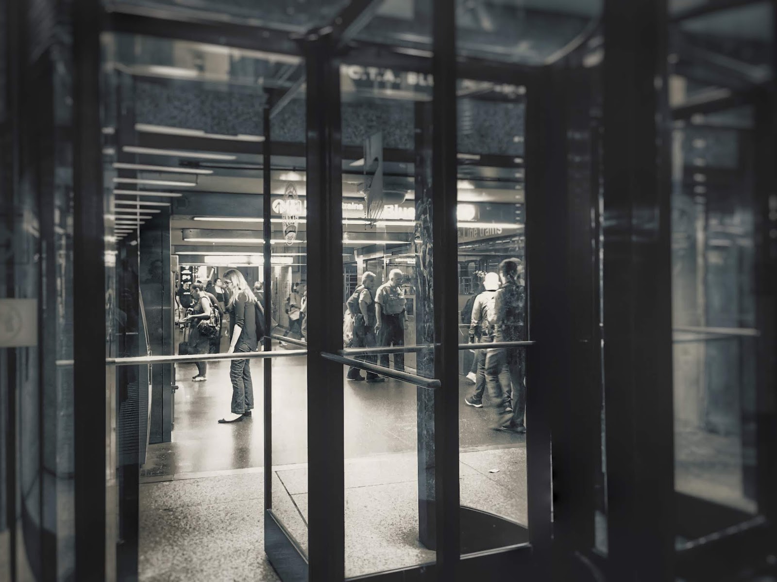
As for photography, I've taken a new interest in shooting black and white (actually, silvertone) photos. I am exploring what is real and what is not. How the image of the city is constructed through our thoughts. Always there is an element of dreams to what we see.

The beer garden along the Riverwalk.
The autumn season. Shadowy figures crossing Wabash.
Corner clock on the Palmer House Hotel.

The Vietnam Veterans Memorial along the Riverwalk. Wedding couple on far left stairs.
The canopy of lights at the Palmer House Hotel.
Doorways of the Chicago City Hall/Cook County building.

The Riverwalk.

The entrance to the Blue Line along the underground tunnels of the Pedway.

Vending machines and snacks in the Pedway.


Tuesday, May 17, 2016

Englewood


Jahmal Cole runs the group My Block, My Hood, My City (MBMHMC) to encourage Chicagoans to explore the different neighborhoods of the city. MBMHMC takes young people monthly to visit new areas. In April 2016 he started a series of walks to encourage the public to see places they might not otherwise visit. My husband and I joined “Explore Englewood”.

We boarded a southbound bus in our neighborhood of Hyde Park. In Woodlawn we transferred to the 63rd Street bus going west to Englewood. The area wasn’t far from our home, but I’ve never been there. It’s somewhere I don’t generally feel comfortable walking on my own. Meeting a group did encourage us to make the trip.

Everyone gathered at St. Benedict the African-East Church. Tables were set up with information from neighborhood groups and maps with points of interest. Then everyone left on their own to explore and meet together later at a café for lunch. My husband and I began to wander the area.

As we walked Englewood I noticed all of the lots and lawns had been neatly mowed. In its glory days Englewood was a grand neighborhood filled with expensive mansions. In recent times, it has fallen on hard times. However, there are still people who obviously take pride and care for the area.

Upon closer inspection I began to notice that, unlike the North Side, few of the old homes were completely restored. Pieces of the houses were sometimes gone, such a missing spire from a turret, or more perplexing, a spire with a gap where the turret should be. We often saw deferred maintenance, missing or boarded architectural elements, and lots of siding.

I’d read an article in the South Side Weekly about how the housing market crash and subsequent foreclosures continues to devastate certain areas of the city. After Riverdale, the next highest vacancy rates are a cluster in Woodlawn, Englewood, and West Englewood. Even so, I wasn’t prepared for the overwhelming number of boarded homes and vacant lots.

I’d been to East Garfield Park, which experienced high rates of fires and looting during the April 1968 riots. Many buildings in that area of the West Side were burned and later removed, leaving numerous vacant lots.  Almost every business and factory left. Still, East Garfield Park seems more stable now than some areas of the South Side.

According to what little is remembered about the South Side, rioters in April 1968 marched along 63rd Street from Woodlawn to Halsted in Englewood, once the second busiest shopping district in Chicago. It was the same route we’d followed on the bus. Later accounts claimed, because of stronger community leadership, the South Side April 1968 riots were quickly quelled and the communities didn’t suffer the same fate as the West Side.

Regardless, the resulting long term damage from the 1968 riots seems to be similar for both neighborhoods. There was a mass exodus of businesses and many buildings have been reduced to vacant lots in Englewood, just like East Garfield Park. Except the foreclosure crisis hasn’t deeply impacted many places as badly as here. Englewood continues to erode from both historical and recent crises.

The only complete blocks of well-maintained homes, without empty units, appeared to be the newer charity or public housing projects, at least where I walked. Otherwise, nearly everywhere was distressed. It was common to see people living in between boarded and vacant units. I would also see second stories occupied while the first floors were closed off. While sealing the lower levels of abandoned buildings was common, only some had the upper windows boarded.

Homes with people living in them had their curtains drawn and windows closed, despite the beautiful Saturday afternoon. No one seemed to feel it was safe to leave them open. Some of the boarded buildings had a window or two exposed, where the boards were removed. Reportedly they are used for illicit activities, like gangs, drugs or prostitution.

Most of the areas we walked were eerily quiet. With all of the green vacant lots it reminded me of being in the country. We heard lots of crickets. Despite the warmer weather kids weren’t playing out in the fields or parks. Almost no one was walking around. Residents stayed on their porches and kids were only allowed a few feet from their front doors. The playgrounds we passed were completely empty.

Later I was told a railroad company was buying a section of Englewood, tearing the buildings, to expand their railyards into the neighborhood. I suddenly wondered if that was the section we’d traveled? It would have explained a lot. After researching I found out we never saw the railroad expansion area.

We met back with MBMHMC at the Dream Café. Despite the continued distress in Englewood, there are people working to make improvements. New investments are happening, like the building of a Whole Foods grocery store. Local entrepreneurs have met with the store about marketing their products.

There are people who clean trash in front of vacant buildings and plant spring bulbs. I saw an active Little Free Library; which volunteers were keeping stocked with giveaway books. I saw a planter of flowers placed out by the road to enliven the entire street. Residents are fighting to restore their neighborhood.

We enjoyed lunch. My husband tried the jerk chicken and rice, while I couldn’t resist sampling chicken and macaroni and cheese. The pasta had some extra peppers and spices. Afterwards, we walked over to the Aldi grocery store. My husband wanted to see it, as he’s read a lot about how the store significantly undersells Wal-Mart. They’ve brought affordable groceries to food deserts, particularly on the South Side.

I didn’t have a quarter with me to unlock the grocery cart. Aldi gets customers to return carts by charging a deposit. They operate on almost no staff and limited selections of only a brand or two for each item, which lowers their costs. Inside we found the store clean and well lit. Cashiers were extremely fast. We managed to grab a couple bags worth of food and the cashier graciously lent us a cart to bag them.

I’ve seen the location of the H. H. Holmes “Murder Castle” (of Devil in the White City fame) listed as the Aldi store in Englewood. Others cite it being across the street, where the post office is now located. Not surprisingly, the post office is rumored to be haunted. That’s where we caught the bus home.


Tuesday, March 22, 2016

East Garfield Park


There are neighborhoods in Chicago I don’t feel comfortable walking without guidance. The biggest issue is crime. Will I be safe? The answers are difficult to find, despite diligent online research.

Googling “Chicago’s worst neighborhoods” yields interesting results. A lot of the answers, particularly in forums, tends to reflect perceptions rather than actual statistics. Tourists worry more about being mugged in a very poor neighborhood, when they should be aware that garden variety pick pockets tend to congregate where the action is—tourist hot spots, particularly when late night bar hopping is added to the mix.

Searching online some neighborhoods, like Auburn Gresham, North Lawndale, and Washington Park, tend to show up consistently on “bottom” lists. East Garfield Park, while suffering from higher than average city crime rates, isn’t a shoo in for a “worst 10” neighborhood. The numbers vary. The discussion forums are a different matter. The comments constantly warn against visiting.

While I wouldn’t advise walking unfamiliar neighborhoods alone at night anywhere, tourists and many Chicagoans seem unfairly prejudiced against East Garfield Park even during the day. Getting off the green line at the Conservatory L train stop leads directly to one of the most impressive conservatories in the country. I like it better than Lincoln Park and it has more family-friendly areas. There just isn’t much to do beyond the park.

I crossed paths on social media with Dr. Peter T. Alter, Historian and Director of the Studs Terkel Center of Oral History at the Chicago History Museum. He was in the process of helping raise money for "Forty Blocks:The East Garfield Park Oral History Project.” It would train students from Breakthrough Ministries' Art and Science Academy to interview local residents about the neighborhood.

I have been asked why I don’t document neighborhoods more thoroughly when I visit, particularly the people. The answer is it would require resources like the Forty Blocks project—dozens of committed people, funding, and many hours of work per neighborhood. It takes an entire team.

What Chicago really needs is a Forty Blocks type project in every neighborhood of the city, hopefully produced by the people who live there. I am a tourist of the city taking snap shots of the architecture, capturing a particular place and time.

Alter suggested lunch at the Inspiration Kitchen, located near the conservatory. I had chicken and waffles with an egg, creole mustard, and cayenne syrup. Coming from the spicy Southwest I found the sauces mild but good. Alter had a catfish PoBoy.

I’m always hesitant to walk through a new neighborhood with someone I don’t know. Luckily, Alter has experience working with media and film crews. He was already trained to stay out of the way of my camera view. Beforehand, I realized it was kind of rude of me to suggest he show me around, then only pay half attention to what he was saying as I became engrossed in photography. I was able to solve the issue by getting some video clips of his tour.

In hindsight, I was glad he was there. I didn’t always understand what I was seeing. East Garfield Park is a once prosperous area that has declined dramatically from the 1950s. More than two-thirds of the residents have left. The area is Chicago’s own piece of the Midwestern rust belt. I felt like I was looking at Detroit.

Alter explained Chicago had two major periods of riots in 1968. The summer riots of the Democratic convention are well known. But earlier that year, in April, riots broke out across the city after the assignation of Dr. Martin Luther King, Jr. While King lived in Chicago he was based in the neighborhood just south of the train tracks, in Lawndale. Historically, the area was one of the first places in the western part of the city to be settled by blacks leaving the South Side after World War II.

During the April riots a significant number of homes and businesses burned in Lawndale and some surrounding areas. They were never rebuilt. The empty lots we were seeing in East Garfield Park weren’t just due to the recent housing crisis. There had been a mass exodus of factories, businesses and jobs since mid century.

During the last housing boom there was a lot of speculation about East Garfield Park gentrifying. It’s close to downtown and has good public transportation. Looking around I had to wonder—gentrify what? So much of the neighborhood is simply gone. It’s not going to be the work of fix-and-flippers or hipsters.

If the neighborhood is going to change it would take an effort like the Chicago Housing Authority in Bronzeville, transforming large blocks at a time with mixed income housing, or the South Loop, where developers are inserting large luxury projects. Even then, both of the aforementioned communities lack significant business development.

Walking around I thought I saw signs of new commercial investment in the neighborhood. I pointed out a great little grocery store. Alter explained no, it was actually a food pantry run by Breakthrough urban ministries. Ditto for the gym, child care and health center. Our lunch restaurant was likewise a social service. Almost no commercial businesses exist in the area. We did pass an urban farm with a B & B nearby.

Residents have few services. Our tour was in early March. Several times we resorted to walking in the street because sidewalks were coated in sheets of ice. They wouldn’t be cleared until they melted. The situation is particularly difficult for the elderly. When I later looked online I was surprised at how high the neighborhood rents are given the condition of the area.


We ended the tour by walking down the once grand West Washington Boulevard. Some of the old mansions remain. To the west it terminates at the extraordinary Garfield Park field house owned by the city park district. Parting ways with Alter I explored the incredible marble and metal work inside. It’s one of Chicago’s relatively unknown architectural treasures, at what was once one of the country’s grandest parks, in what was one of the finer neighborhoods.


Wednesday, March 16, 2016

South Loop, Near South Side


On an unusually warm Sunday in late February my husband, daughter and I decided it was time for another neighborhood visit. A day earlier the city had been hit hard with storm gale force winds, causing widespread damage. Debris was littered everywhere. Service was still not fully restored to the downtown L trains. Likewise, buses were unusually crowded. We decided to stick close to home.

One of the biggest challenges doing my project is finding neighborhoods which look decent in photos during bleak winter days. Most places look best when lawns are green and flowers are in bloom. I’ve tried to cover the communities with the least amount of greenery during the coldest months. I picked South Loop to walk. The area is a dense mix of former wealth and extreme segregation, along with former industry and an abandoned red light district, without much landscaping.

Another challenge is figuring out the boundaries of the community areas. Chicago is one of those cities where dividing lines don’t stay put. For my previous neighborhoods I have relied on The Chicago 77 by Mary Zangs as my guide. I purchased the book at the Chicago Architecture Foundation, figuring they would have the most accurate information.

South Loop is a rapidly changing area. New skyscraper residential buildings have sprung up in what was historically the less desirable South Side. Zangs’ book lists the South Loop as stopping at Roosevelt Ave, where the Near South Side starts, as two separate neighborhoods.

The suddenly fashionable community south of Roosevelt Ave has been rebranded as part of The Loop rather than the South Side. The other guides I consulted, and Google Maps, show South Loop overlapping the entire Near South Side, with one exception—the shore line. The community area south of Roosevelt Ave has almost no access to the lake front. The lake shore, Museum Campus, and Northerly Island are separated from the residents by both freeway and railroad tracks.

While many of the sparkling new high rises have views of the lake, it’s a long hike for most residents to walk there. Otherwise it seems like a pleasant neighborhood, if still a bit rough around the edges. I was also surprised how few restaurants and retail services are available in such a densely populated neighborhood.

Rents have increased, particularly with the construction of newer luxury buildings, although the prices are still considered a bargain compared to similar buildings on the North Side in and around downtown.

We started our tour on the eastern side of the neighborhood from Museum Campus. The walk was enjoyable because townhomes line the sidewalks. I didn’t feel walled in by the high rises, like I did when I visited downtown Miami. Families gathered in parks and along the sidewalks.

We wandered across the Clarke Museum, a small white home in the middle of a compact park. Built in 1836 it’s fabled to be the oldest home in the city. Nearby is the Prairie Avenue Historic District, which once housed the wealthiest citizens after the Great Chicago Fire. A few of the mansions still remain.

We headed over to the western side. The area isn’t as good for walking. Some buildings remain abandoned and there is little to stop and do along the way. We passed blank areas of unapproachable landscaping and a large gated community near a freeway underpass.

We planned to grab an afternoon coffee. But as we reached the northern edge of the Near South Side by Roosevelt Ave the shops had long lines out the door. We ventured a bit further north to a diner. We sampled the difference between a traditionally grated potato latke versus a new improved version with pureed potatoes. The pureed latke reminded me of fried mush I’d eaten as a kid in NE Ohio. After potato overload we headed for home.