Wednesday, September 25, 2019

Silvertone Chicago Vol.1


The corn cob towers.

This is the first time I've posted to the Chicago Neighborhoods Project in years. I stopped because I found trying to keep up with several types of social media was too time consuming. I am most active on Twitter at @ChiNeighbor. I have been tweeting videos of the city. I also feature snippets of Chicago Tribune newspaper articles from 1893 about the city and the World's Fair.

My longer term project is tentatively called "Tarot in the White City: Instructions, History and Advice from Chicago." I envision this as a book as centered around the amazing research about tarot that emerged in the early 1890s. Part of this knowledge has gone back into obscurity. For fun, I've designed a way to read tarot with a set of dominoes, a partial deck of playing cards, and a partial deck of modern tarot cards.

Visual Journal of the Fantastical City

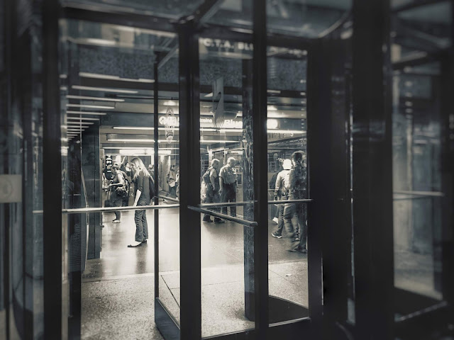
As for photography, I've taken a new interest in shooting black and white (actually, silvertone) photos. I am exploring what is real and what is not. How the image of the city is constructed through our thoughts. Always there is an element of dreams to what we see.

The beer garden along the Riverwalk.
The autumn season. Shadowy figures crossing Wabash.
Corner clock on the Palmer House Hotel.

The Vietnam Veterans Memorial along the Riverwalk. Wedding couple on far left stairs.
The canopy of lights at the Palmer House Hotel.
Doorways of the Chicago City Hall/Cook County building.

The Riverwalk.

The entrance to the Blue Line along the underground tunnels of the Pedway.

Vending machines and snacks in the Pedway.


Saturday, May 13, 2017

Lake Calumet


Historic Native Americans of the Calumet Region


Calumet Pipe

 Early Chicago


Encyclopedia of Chicago

Industrial development became possible in 1869, when Congress appropriated money for a harbor at South Chicago. In the 1890s, the Calumet River was straightened and dredged. Industry began moving into the area in the 1870s, and by the early twentieth century the Pullman Company, the South Works of U.S. Steel, and other industries had been established in southeast Chicago and Hammond. To accommodate industry, the channel of the Grand Calumet was moved and straightened. The Indiana Harbor Canal connecting the Grand Calumet with Lake Michigan at East Chicago was completed in 1906, and industries moved to its banks. Burns Ditch, completed in 1926, connected the Little Calumet with Lake Michigan in Porter County, draining thousands of acres of marsh and facilitating development. Parts of the Grand Calumet and Little Calumet drained into the lake at these new outlets, depending on rainfall and lake levels. This harbor complex became the most important on the Great Lakes. With steel mills, oil refineries, chemical plants, packinghouses, and other industries, the Calumet system became the industrial center of the Chicago region. Since the model town of Pullman was built near its western shore in the early 1880s, Lake Calumet has been drastically altered. Vast areas of it have been filled in with refuse and converted to use as parkland and docks, while extensive dredging has deepened other parts to accommodate shipping.

 Abe Kleinman

September 1876
The Pigeon Shooter Takes a Shoot at Higher Game.
Drunken Revelry at Shang Noyes’—Sudden End of the Jollity.
Charley Creighton, of South Chicago, Receives a Serious Wound.
The Sportsman Locked-Up in the Hyde Park Calaboose.

 Irondale Wants New Name

July 1903

Muskrat Hunting in Chicago River; Animals Furnish Fur

January 1908

 For Lake Calumet Harbor

October 1908

Big City Harbor on Lake Calumet Finally Assured
December 1922


Louis Armstrong - Muskrat Ramble

YouTube: Louis Armstrong - Muskrat Ramble. 29 feb, 1926. Armstrong (tp), Kid Ory (tb), Johnny Dodds (cl), Lil Armstrong (p), Johnny St. Cyr (bj).

Chicago Police Tell Fight for Lives in Rioting

June 1937

Mill Workers’ Social Center Made Possible by Clubwomen

March 1938


Chicago Area’s No. 1 Industry is Steel Making

January 1940


New Bus Route to Calumet War Plants Is Ready

December 1942


Rails Move for Truce in Calumet Row

September 1949

Mark 75 Years of Steel Making in Chicagoland

June 1950


Vet Protests South Deering Rezoning Plea

November 1950


Parade Roseland 1960s - Muskrat Pete 1940s, Speedboat ride down Calumet River 1950's

YouTube

Face Lifting Belies Age of South Deering

April 1954

Lake Calumet Harbor: Chicago’s Gateway to the World

October 1958

Lake Calumet Rich in History Legend

July 1959


The 8 Nurses: 5 Hour Killing

July 1966

Mission is Port of Call for Lonely Seafarers

September 1966

Seek New Dumping Sites

October 1967 

Incinerator Stoker

February 1972

Lake Calumet Complex Stalled, Waiting Landfill

October 1975

Free Trade Zone to Open Near Lake Calumet Port

November 1975


Vandals Hit Pantry at South Side Church

January 1988


Lake Calumet Dumping Ground Declared a Superfund Site

March 2010

Ask Geoffrey: What’s the Plan for Lake Calumet?

October 2016

Photos of South Deering


April 2017


Thursday, February 9, 2017

Chicago: City of Bridges

When my daughter was around 4 years old we lived in Albuquerque, New Mexico. She was fascinated by bridges. She had a children's video about them, which she watched over and over, like kids will do. That summer we took a car trip with my mother, from our home, to Cleveland. When we arrived up north my daughter was amazed at the variety of bridges.

The highlight of the trip was our return home. My daughter and I left Cleveland on the Amtrak train back to the Southwest. We had a 5 hour layover transfer in Chicago. I don't know of any other city in America that can match Chicago for bridges. We were in awe.

Chicago has all the typical city bridges--freeway overpasses, rail lines, pedestrian walkways at airports, and connectors over rivers. In addition, the city was built in a swamp. Therefore, buildings are constructed in layers above the ground. Wacker Drive in downtown has three distinct levels, plus additional pedestrian links. To walk around the heart of the city is to constantly climb stairs and cross bridges.

The city has some unusual bridges. Part of the Pedway system is skyway bridges. It's is not limited to underground tunnels. There are industrial relics across the rivers. The Chicago Park District has an abundance of historic pedestrian bridges. If you look around you will find them everywhere.

When my daughter and I got off the train that summer trip I was surprised how accessible downtown Chicago was to the surrounding neighborhoods. It's easy to find somewhere to walk across the river. In some cities, like Los Angeles, few people walk. In other cities, natural barriers are too great. In New York there are few crossovers that span the long distance between Brooklyn and Manhattan. 

Still other places were designed without consideration for pedestrians. Getting in a vehicle, or riding the elevated free mass transit automated people mover, is the only way to get around downtown Miami. Chicago is unique.

Chicago is a city of bridges.
Vintage Postcard of Chicago Skyline
Downtown Chicago
Chicago River
South Branch of Chicago River
Uptown
South Loop
Pilsen
Lincoln Square
Lakeshore East
Hyde Park
Englewood
East Garfield Park
Chinatown in Armour Square
Bridgeport

Saturday, January 7, 2017

Chicago's Original Chinatown

My blog was inactive while I worked a job over the summer and fall. This winter I'm pleased to be back to my research, writing and photography on the Chicago Neighborhoods Project.


As I walk around the city I'm always curious if what I'm reading as an official guide is the same as what I'm seeing in the architecture. While it's easy to edit out words from texts, the buildings still retain details of history, which have since been omitted from written accounts.

When I spot these irregularities I can research to find out the rest of the story.

Chicago's designated Chinatown, on the South Side, looks like a tourist destination to me. It was built with exaggerated architecture, drawing attention to itself, at a time when the Chinese in the USA were a target for extreme prejudice and even physical attacks. Asians are the only nationalities we've completely banned from entering the country. This creates a big question. Why would the new Chinatown purposely stand out?

After hunting around I came across a 1911 article in the Chicago Tribune which details the gentrification of Chicago's original Chinatown, located in downtown, and plans for a new Chinatown. In the original Chinatown people were trying to keep a low profile, as would be expected.

Below I explain what I found in the article.
Half a block is what's left of Chicago's original Chinatown

Link to the article here.

Be forewarned--it's racist and offensive in the descriptions of various ethnicities.

Chicago Tribune 1911

A reporter walks around what was the original Chinatown, in the south end of The Loop. The article was published on January 22, 1911. He describes the gentrification of Chinatown, as the business district is expanding. A skyscraper was expected to be built at Clark & Van Buren. The Chinese restaurants are being replaced by lunch counters catering to office workers.

The reporter describes Chinese men being forced to cut off their "pigtails". He also references the requirement of Chinese to be photographed and documented, like a Muslim registry would today.

He complains about the Chinese becoming Americanized and going into mainstream society. He laments the arrest of the gang leaders in the Tong Wars, rivalries over illicit activities like smuggling drugs, opium dens, prostitution and gambling, being pushed out of downtown.

(At this time the city was working on getting rid of vice too close to the business district. The entire vice district was being pushed south.)

He laments the lack of a tourist destination, similar to what has already been built in NYC and San Francisco. Chicago doesn't yet have the flashy California Crazy roadside vernacular architecture, which was luring auto tourists to other cities to visit their Chinatowns.

He hints a new Chinatown, designed for tourists, is being planned.

The original Chicago Chinatown was larger than 2 blocks on Clark Street. He describes an exclusive Chinese residential area on Federal, composed of a respectable hotel and brownstones.

Interestingly, he mentions a Bohemian enclave nearby, being frequented by Americans. I've read the term hipster comes from opium dens, because opium pipes are smoked while lying on your side. These white folks would bring the "bohemian lifestyle" into the mainstream.

Finally, as an aside, I'd never heard of Floaterville-by-the-tracks, the place where a community of people live on boats for the winter.


Conclusion

In conclusion, my assumption was correct. While the new Chinatown would become the center of the Chinese community in Chicago, it was built as a tourist destination for people traveling by car.


Article:
http://archives.chicagotribune.com/1911/01/22/page/61/article/fall-and-passing-of-chinatown-hing-kee-dinks-under-a-pall

Sunday, May 22, 2016

Budget Guide to Chicago

Summer 2016


When the weather warms tourists flock to Chicago. Since I get requests for advice about what to see and do in the city, I’ve compiled a budget guide for visiting. Please feel free to leave your own tips.


Choosing What to Visit


Finding the expensive attractions is easy. They are well known. They appear on every website and guide book. Whenever I travel I’m on a limited budget and appreciate finding the cheap stuff. I prefer to blow my money on one big great thing, then supplement the rest of the trip with low cost or free activities.

The first time I go to a new city I spend most of the time simply walking around. If I’ve already been somewhere I prefer a return visit to explore a theme. In a metropolitan area as large as Chicago there is no way to cover all the museums from Millennium Park north to Lincoln Park, let alone the rest of the city. The sheer number of choices is overwhelming.

When friends come to visit I’m left trying to find out clues about what might interest them. If they like architecture, do they want to explore a larger area by walking on our own, or do they want a shorter, but much more informative, professionally guided tour? Do they prefer trolley, subway, bike or walking? (I draw the line at Segways.)

What aspect of architecture is compelling? Do they want skylines and a history if how Chicago developed? Or do they have a specific interest in churches, gothic architecture, hotel lobbies, Frank Lloyd Wright, park district field houses and conservatories, high end retail buildings, famous restaurants, train depots, public markets, or something else?

 Pick a Theme


I like to explore a city around a theme. Right now I’m interested in the Edwardian Era of history. In Chicago I would take some architectural tours of buildings and foods (Chicagoans often combine architecture and eating or drinking), check for museum exhibits, and visit some house museums like Glessner.

If you’re looking for something educational you might explore birds, Civil War history, cooking and foods, bridges, or whatever floats your boat. Chicago has a number of museums and cultural centers devoted to specific ethnic heritages, including Swedish, German, Lithuanian, African-American, Ukrainian, Mexican and Puerto Rico.

Chicago has an endless number of tours, concerts and lectures. The universities often have free or low cost theater, music and lectures. Likewise, neighborhoods sponsor inexpensive events.

In my own neighborhood of Hyde Park this summer we’ll have a series of free weekly evening concerts on our main street (53rd), free park concerts and movies, a free 3-day Jazz Festival, gallery openings, inexpensive museums on the University of Chicago campus, 4th of July parade and picnics with fireworks all night, fire pits for cookouts at Promontory Point, lectures, author readings, a new comedy club, and stuff I’m probably forgetting.


I haven’t listed the neighborhood restaurants, architecture, main business district, book stores, public sculptures, the cluster of seminaries, the lakefront, beaches, or the parks. We’re just one small area of the city, yet we have more cultural institutions than some entire small cities.

 
Pick an Area of Town


I recommend sticking to a particular area of the city rather than trying to cover a large territory. Why waste vacation time stuck sitting in traffic or waiting for the subway? Some of the neighborhoods have easy access on public transit to The Loop, Navy Pier, or the Magnificent Mile, but plenty of neighborhoods don’t. If everything you want to do is near the Navy Pier, paying higher hotel costs is worth the easy access.


Leave the Car at Home


I don’t recommend driving around Chicago. It may seem cheaper, until you have to pay parking. Some hotels offer lower room rates with expensive parking garages. Be sure to find out both. Driving to places like downtown is a nightmare and you’ll have to pay for parking. Other neighborhoods require a long search for a free spot.

You may find an inexpensive AirBnB rental with free parking. Fine, but how are you going to get to tourist attractions? Will you have an hour bus ride each way, including having to transfer? Are you going to drive and pay high parking fees when you arrive at your destination?

 
You Don’t Have to Visit the Art Museum


I hereby give you permission to skip anything which doesn’t interest you. You might be happier spending $300 on one of the best dinners of your life rather than slogging through days of boring museums.


Budget Ideas


Since money doesn’t grow on trees, here are some ways to see and do popular attractions without breaking the bank.

·         Discount Tickets: There are passes, Groupon, and last minute discounts.
·         Skyline: Instead of the Willis or Hancock towers, grab a drink at a rooftop bar.
·         River: Take the water taxi from Michigan Ave to Chinatown.
·         Meet Up: Check for free public tours.
·         Museums: Visit less well known museums.
·         Discount Shopping: Chinatown, Clark St in Andersonville, 26th St in Little Village


Links to Low Cost/Free Stuff


Chicago on the Cheap http://chicagoonthecheap.com/


Tuesday, May 17, 2016

Englewood


Jahmal Cole runs the group My Block, My Hood, My City (MBMHMC) to encourage Chicagoans to explore the different neighborhoods of the city. MBMHMC takes young people monthly to visit new areas. In April 2016 he started a series of walks to encourage the public to see places they might not otherwise visit. My husband and I joined “Explore Englewood”.

We boarded a southbound bus in our neighborhood of Hyde Park. In Woodlawn we transferred to the 63rd Street bus going west to Englewood. The area wasn’t far from our home, but I’ve never been there. It’s somewhere I don’t generally feel comfortable walking on my own. Meeting a group did encourage us to make the trip.

Everyone gathered at St. Benedict the African-East Church. Tables were set up with information from neighborhood groups and maps with points of interest. Then everyone left on their own to explore and meet together later at a café for lunch. My husband and I began to wander the area.

As we walked Englewood I noticed all of the lots and lawns had been neatly mowed. In its glory days Englewood was a grand neighborhood filled with expensive mansions. In recent times, it has fallen on hard times. However, there are still people who obviously take pride and care for the area.

Upon closer inspection I began to notice that, unlike the North Side, few of the old homes were completely restored. Pieces of the houses were sometimes gone, such a missing spire from a turret, or more perplexing, a spire with a gap where the turret should be. We often saw deferred maintenance, missing or boarded architectural elements, and lots of siding.

I’d read an article in the South Side Weekly about how the housing market crash and subsequent foreclosures continues to devastate certain areas of the city. After Riverdale, the next highest vacancy rates are a cluster in Woodlawn, Englewood, and West Englewood. Even so, I wasn’t prepared for the overwhelming number of boarded homes and vacant lots.

I’d been to East Garfield Park, which experienced high rates of fires and looting during the April 1968 riots. Many buildings in that area of the West Side were burned and later removed, leaving numerous vacant lots.  Almost every business and factory left. Still, East Garfield Park seems more stable now than some areas of the South Side.

According to what little is remembered about the South Side, rioters in April 1968 marched along 63rd Street from Woodlawn to Halsted in Englewood, once the second busiest shopping district in Chicago. It was the same route we’d followed on the bus. Later accounts claimed, because of stronger community leadership, the South Side April 1968 riots were quickly quelled and the communities didn’t suffer the same fate as the West Side.

Regardless, the resulting long term damage from the 1968 riots seems to be similar for both neighborhoods. There was a mass exodus of businesses and many buildings have been reduced to vacant lots in Englewood, just like East Garfield Park. Except the foreclosure crisis hasn’t deeply impacted many places as badly as here. Englewood continues to erode from both historical and recent crises.

The only complete blocks of well-maintained homes, without empty units, appeared to be the newer charity or public housing projects, at least where I walked. Otherwise, nearly everywhere was distressed. It was common to see people living in between boarded and vacant units. I would also see second stories occupied while the first floors were closed off. While sealing the lower levels of abandoned buildings was common, only some had the upper windows boarded.

Homes with people living in them had their curtains drawn and windows closed, despite the beautiful Saturday afternoon. No one seemed to feel it was safe to leave them open. Some of the boarded buildings had a window or two exposed, where the boards were removed. Reportedly they are used for illicit activities, like gangs, drugs or prostitution.

Most of the areas we walked were eerily quiet. With all of the green vacant lots it reminded me of being in the country. We heard lots of crickets. Despite the warmer weather kids weren’t playing out in the fields or parks. Almost no one was walking around. Residents stayed on their porches and kids were only allowed a few feet from their front doors. The playgrounds we passed were completely empty.

Later I was told a railroad company was buying a section of Englewood, tearing the buildings, to expand their railyards into the neighborhood. I suddenly wondered if that was the section we’d traveled? It would have explained a lot. After researching I found out we never saw the railroad expansion area.

We met back with MBMHMC at the Dream Café. Despite the continued distress in Englewood, there are people working to make improvements. New investments are happening, like the building of a Whole Foods grocery store. Local entrepreneurs have met with the store about marketing their products.

There are people who clean trash in front of vacant buildings and plant spring bulbs. I saw an active Little Free Library; which volunteers were keeping stocked with giveaway books. I saw a planter of flowers placed out by the road to enliven the entire street. Residents are fighting to restore their neighborhood.

We enjoyed lunch. My husband tried the jerk chicken and rice, while I couldn’t resist sampling chicken and macaroni and cheese. The pasta had some extra peppers and spices. Afterwards, we walked over to the Aldi grocery store. My husband wanted to see it, as he’s read a lot about how the store significantly undersells Wal-Mart. They’ve brought affordable groceries to food deserts, particularly on the South Side.

I didn’t have a quarter with me to unlock the grocery cart. Aldi gets customers to return carts by charging a deposit. They operate on almost no staff and limited selections of only a brand or two for each item, which lowers their costs. Inside we found the store clean and well lit. Cashiers were extremely fast. We managed to grab a couple bags worth of food and the cashier graciously lent us a cart to bag them.

I’ve seen the location of the H. H. Holmes “Murder Castle” (of Devil in the White City fame) listed as the Aldi store in Englewood. Others cite it being across the street, where the post office is now located. Not surprisingly, the post office is rumored to be haunted. That’s where we caught the bus home.